


Unleashing Maharashtra growth through Konkan Expressway with 16 Smart Secured Cities for Self sustained state’s Economy
By Dr. Vijay Page

Ex MD Konkan Development Corporation Ltd and DG, MET.
By Dr. P. Sekhar

Chairman, Global Smart Cities Panel & Micro Tech Global Foundation
Overview of Greenfield Konkan Expressway
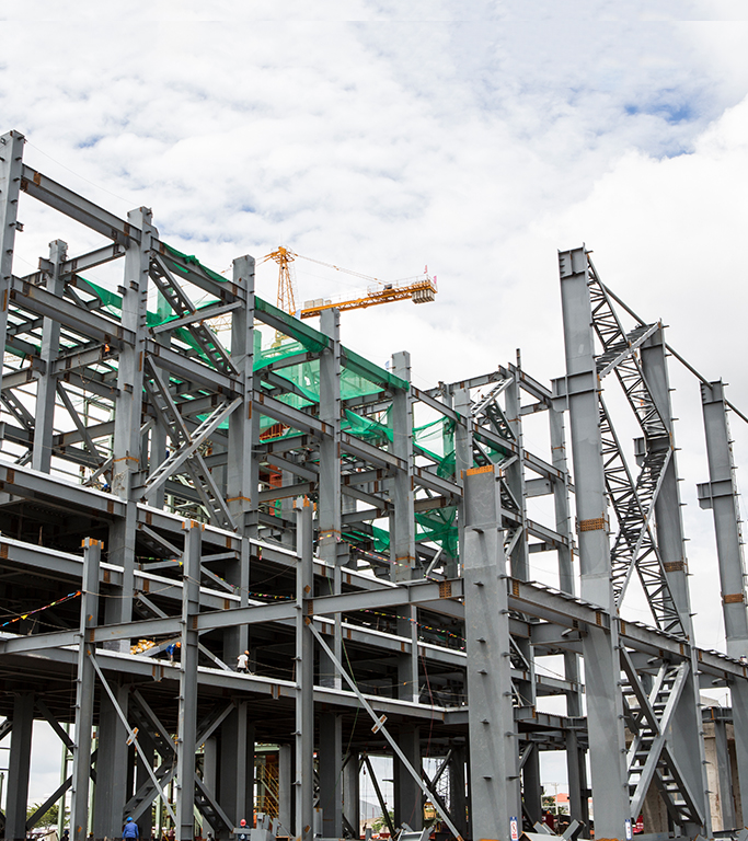
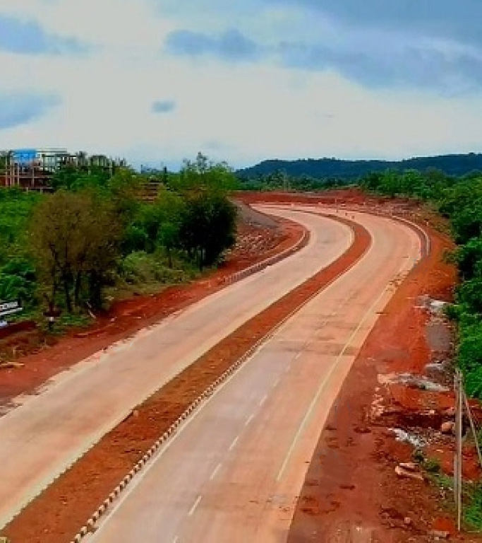
Government of Maharashtra is planning to construct a 500-km Greenfield Konkan Expressway from Mumbai to Goa. The expressway will be constructing along the lines of Mumbai-Nagpur Expressway and will starts from Chirle village in Navi Mumbai and end at Patradevi village on the Maharashtra-Goa border. This project expected to provide a boost to economic growth in the 03 passing districts and adjoining districts and many villages. The Greenfield highway will connect Raigad, Ratnagiri and Sindhudurg districts of Konkan which will run parallel to the sea coast.

Multi Modal Corridor (MMC)
The genesis of the proposed MMC is the Comprehensive Transportation Study (CTS) for the MMR conducted by MMRDA, also known as TRANSFPRM (Transportation Study for the Region of Mumbai), with technical assistance from World Bank under the Mumbai Urban Transport Project (MUTP). The prime objective of TRANSORM was to identify the travel pattern of residents in the MMR and recommend long-term comprehensive transportation strategy with a horizon year of 2031, one of the recommendations of TRANFORM was to develop the MMC from Navghar to Chirner in Tah. Vasai to Chirner Tah. Kalyan, also known as the Ring Road.
The starting point of this proposed multimodal corridor from Navghar to Chirner of length 85.535 Km. is at village-Bapane of Tah. Vasai & end point of this corridor as at Chirner of Tah. Kalyan with Ch. Km. 85.535. The grades proposed for these alternatives are well within permissible limits i.e. 1:18. The horizontal curves are designed for the apexes having deflection angle 75 degree.
The proposed Multi Modal Corridor:
- 1). Total Length Requiring Construction: 85.535 Km.
- a). Length through Forest area: 8.71 Km.
- b). Length through non Forest area: 76.824 Km.
- c). No. of villages through Forest: 14 village/s
- d). No. of villages through Non-Forest: 35 village/s
- 1). Additional land width proposed: Av. 99 Mt.
- 1). Number of interchanges: 8
- 1). Number of vehicular underpasses: 28
- 1). Number of pedestrian underpasses: 16
- 1). Number of culverts: 120
- 1). Type of tolling system: Closed system
- 1). Estimated cost: 1600 Cr.
Ratnagiri District
Ratnagiri district is one of the most important maritime districts of the Maharashtra State with the coastal belt extending to about 167 kms. The district is also famous for Ganapati Pule’s ‘Ganesh Temple’. It is a major pilgrim centre of Maharashtra and famous for white sandy beach. Alphonso mango of Ratnagiri district is known as the king of mangoes. Foreign exchange earner ‘Alphonso’ mango is grown throughout the district.

Ratnagiri can be physically divided into 3 zones. Coastal Zone – This zone extends to about 10-15 km from seacoast. Most of the activities in this area are connected with sea. This area contains numerous beaches, creeks, sea forts, harbors, hot water springs, caves, temples and other religious places, places of scenic beauty as well as birthplace of some great personalities. The possible tourist activities include inland and sea water ways, sailing, boating, water sports like water scooter, canoeing, fishing, camping, marinas, coastal resorts and marine parks; but the major problem is the lack of easy accessibility and road network. Hill area Zone – This area includes the western slopes of Sahyadri and extends up to about 10-15 km. places and hot water springs. The other important rivers in the district are Shastri, Bav, Ratnagiri (Kajali) Muchkundi, Jaitapur and Jagbudi. The district has numerous small creeks named Kelshi, Kalabadevi, Palshet, Borya, etc.
Raigad District
Raigad is one of the districts in Konkan Division of Maharashtra and Arabian Sea coast forms western boundary of the district. Most hilly places of the District are in the Sahyadri mountain range. Previously known as Kolaba, it was rechristened as Raigad District.
Raigad is known for its scintillating historical places, pristine beaches, picturesque landscapes and diverse flora and fauna of Western Ghats. Religious places in the district like Ashtavinayak Temples, Elephanta caves etc. are sole testimonies to its rich cultural past. Culturally, Raigad has been the ever vibrant community with population of different religions, dialects, ethnicity etc. Few places in the Raigad district are historic hinterland of the Bene-Israeli Jews.
Raigad has been bestowed with surreal & magnificent forts viz. Raigad Fort, Kolaba Fort, Murud-Janjira Fort, Sudhagad Fort etc. Dr. Babasaheb Ambedkar Technological University in Raigad, is the only Technological University in the State of Maharashtra. From Industrial Complexes of national importance to the internationally renowned scientific institutions, Raigad is constantly taking strides to the forefronts of 21st century.
Sindhudurg
The earlier Ratnagiri district was divided into two districts, Ratnagiri and Sindhudurg on 1st May 1981 for the industrial and agriculture development of the southern part of the Konkan division. Sindhudurg district covers an area of 5,207 km. For administrative convenience, it has been divided into 3 sub divisions. Total Talukas – 8, Total Gram Panchayats – 431 Total Revenue villages –752, Total No. Of Saja - 236 Urban Local Bodies – 8. There are six major rivers in the district. Vaghothan, Sukhnadi. Tillari, Karli, Gadnadi and Terekhol.
There are 2,587 industries situated in 3 Industrial Estates viz. The main industries are Plastic Engineering, Aluminium, Cashew Processing, Oil Paints, Cement Pipes. In order to promote tourism in the Konkan region the Government of Maharashtra has declared Sindhudurg District as ‘Tourism District’. This Kokan region of Maharashtra has picturesque stretch of land on the west cost of India, endowed with the beautiful seashore, picturesque mountains and scenic natural beauty. This district is famous for tropical fruit like Alphonso mango, cashew, coconut, jamun, jackfruit and marine fish and prawn delicacies. Length of sea coast is 121 km with 16000 Sq. km. continental shelf.
Expected Investment
The estimated cost for the entire stretch of the Greenfield Konkan Expressway project is INR. 25,000.00 Crores. The unit cost per km of expressway has been assessed as INR. 50.00 crore (apporx.). The proposed project will set target 16 Smart Secured Cities / HUBs for industrial, development, area development along with entertainment / tourism development / area development, real estate development, emergency rescue centre, medical facilities, food courts, police stations, public toilets, petrol pumps etc. throughout the corridor. Thus this planning will not only reduce time but also improve country’s economic growth. Sustainable HUBs at every 30 kms with wayside amenities like food court, restrooms, internet café, medical unit, petrol pumps etc.
With over 500 kms of corridor, it is apparent that any HUB or growth centre development strategy for the region must necessarily include strategies for collaboration; and connectivity must be a core theme of the strategic road map. Total cost for developing a Sectoral HUB is estimated around INR.50,000 crore per cluster. (Excluding land value). The Maharashtra State Road Development Corporation (MSRDC) is conducting a technical and financial feasibility study of the project. “This Greenfield Expressway will run parallel to Konkan’s coastline and will boost tourism. The plan is to build it along the coastline so that travellers will enjoy the natural beauty of the Konkan, and to develop the coastal tourism of the region. The expressway along the Konkan coastline connecting Nhava Sheva in Raigad district with the border of Maharashtra and Goa besides it will reduce stress on the Mumbai-Goa National Highway. And will give access to Alphonso mangoes, cashew, betelnut, and coconut produced in the region to the international market, and create employment opportunities for the locals, This will require huge additional investment in Maharashtra which in turn will generate further more employment. The expressway will crisscross coastlines of Raigad, Ratnagiri, Sindhudurg district and will help in the development of Konkan and ensure the quicker evacuation of its crop produce such as cashew nut, mangos etc, for the international markets and create more job opportunity as well. The proposed expressway travel time will be reduced to four to five hours from currently 11-13 hours. The results continue to show reductions in business travel time being valued at a significantly higher level than the commuting or leisure values. The expressway will open up tourism opportunities in the Konkan region, generating jobs for locals and giving travellers a chance to enjoy the Konkan coast.
An important feature of the Maharashtra coast south of Mumbai is that the Western Ghats (hills) are running parallel to the coast and the hills. The coastal area is hilly. At many locations, there are large tablelands on top and water front at the foot of the hills. The Greenfield Expressway that will run parallel to the coast can cater to evacuation or entry of traffic linking to ports and boost transport facility in Maharashtra. The hilly terrain makes links between ports and Konkan Railway difficult. Regions on eastern side of hills are not served by the Konkan Railway. This Expressway along the coastal feature could favorable for developing bulk terminals for raw materials to support industries whose products can be evacuated by roads, pipelines or other means are possible only with huge investment, e.g. the cost of developing Expressway in hilly terrain may be very high.
The possibility of such a development would depend on the realization of large volume of traffic, future developments in container shipping needing deeper waters and a need to supplement the JNPT development. The coast is also having many naturally sheltered areas (creeks, bays) that are suitable for captive terminals particularly serving coastal traffic, ship repair and ship breaking yards and tourist resorts.
After the Greenfield Konkan Expressway project development the land values rise in leaps and bounds due to community activity like new express highways, transport links, commercial developments etc. The construction cost of project will be more than equal to the value of HUBs.
Evidence of these benefits is clearly visible in many of the highway projects that have recently been completed throughout the country. So the road developer or investor will get more profit than the capital investment. There are 16 smart cities (HUBs) will be act as a commercial growth centres or social clusters. Private stakeholders will be investing in this smart city under government guidance. The value of the influence area of the project might be increased more than three times of the present value within 2 or 3 years. It facilitates an equal opportunity for Private sector and Government to work together with a single window clearance system to achieve greater results to bring National progress with profitability to the participating organisations. Much of the investments for development will come from Private sector wherein government and its agencies will act as facilitators.
Expected Development Plan along the Konkan Expressway
- 1). There are over one and half dozen creeks in Konkan South of Mhasala creek which can develop for fish breeding and cage culture based fish production activities. These have hood sweet water discharge in monsoon and up-to 8 months of the year so bunds to separate the seawater ingress line could be erected which will allow sweet water storage for cage culture. After study by NIO/MPEDA/CIFE fish culture/shrimp culture and processing HUBs can be planned with youth Self-Help Group (SHG) training and production / processing / storage centres.
- 2). SHG could be trained / facilitated for developing mango/cashew/jack fruit/kokum plantations on turnkey basis from nursery to harvesting with tie ups for processing HUBs located along the Expressway near the creeks to facilitate dual transport network.
- 3). There are over 40 plus Dams in Konkan with big storages but marginal utilization. Water resource utilization is highly capital intensive and has the advantage of application of large-scale effort from these Dams point.
- 4). The advantages of aquaculture particularly include comparatively low capital investment requirements, the intensive nature of the fish culture operations, and the fact that it could be developed as processing HUBs. Super intensive tilapia fillet export through captive SHG based HUBs.
- 5). Develop the creeks as water sports and Tourist spot.
- 6). Examine wind power generation along the ridges on the hills flanking the creeks. They have the tunnel wind power effect from March. April to October / November as well as tidal highs and lows.
- 7). There are 4 Sea Forts and 20 Hill Forts in Konkan with scenic beauty. They be interconnected and networked with high way grid as tourist attractions. [Vehicle Route Problem (VRP)]
- 8). Every 50 km motels with free electricity charging points solar/wind powered with ethnic food and craft HUBs and food choices & food preferences will be different in every 50 kms. in Konkan.
- 9). Local craft bazars, Ganesh idols Pen / Raigad / Wood craft Toys / Ganjifa at Sawantwadi. These can be annexed to the Motels.
- 10). Rare hill millets / Ragi / Mountain Rice / Jitada fish the list is endless. Each motel will be a hit HUB.
- 11). Marine Park at Malvan. Ouster culture at Ratnagiri is rarest of rare attractions on the entire West Coast. They may be networked for success.
- 12). The Freeway should plan for Electric Transportation. Non-conventional sources of energy could be utilized and be cost effective.
Secured Governance advocates a pragmatic approach of taking Advantage of Valuation of Assets Created
This is not new. We all know when development takes place there is valuation in property. Who benefits from this? More often than not it is incidental and taken advantage off by land and property sharks. Imagine a model where this valuation can be ploughed back into the project and also benefit the people around. First the cost of the project is reduced, and can actually be at negligible cost to the government if carefully planned. Next the population sees it as benefitting them and so they participate more enthusiastically, helping with early completion of the project rather than being an impediment.
Public Private Participation (PPP)
The method of execution envisaged is essentially of the Engineering, Procurement and Construction (EPC) model, where concessionaires bid for a project, with the incentive being concurrent areas offered to them for development and commercial use. These will give returns in four to five years which will meet their investment cost. It is better than waiting for 20 years collecting toll to make good the loans taken for a project. While the concessionaire utilizes valuation in a pattern that is part of a larger plan for the area, he also shares this with more and actually adds more value to the whole system. It will be a win-win situation. The SG approach requires the Government to participate as a facilitator and nothing more. The first step is to recognize the merits of a multi-sector approach to infrastructure and conceive projects which may be predominantly one sector but carry with them smaller packages of other sectors. Implied in this is the ability to take decision across ministries and give clearances at one point. The method of implementation will also be peculiar to each project, the place and the local conditions. Single window clearances would therefore have to be the norm, supported by empowered teams that can help conceptualize and clear a project in the SG mould. Once this is done, the execution may be decentralized to specific states or regions. Help from the government will only be required for mid-course corrections where inescapable. The requirement is to move from small to big, from project to project. Each will be unique in itself depending on what the ground and the situation dictates. The method of both valuation and value addition needs expertise and imagination for holistic development in the state through Secured Governance. PPPs are essentially “risk sharing partnerships” between governments and the private sector on financing, designing, constructing and operating public infrastructure and public services. Infrastructure projects are inherently complex and unpredictable, and, under PPP arrangements, governments opt to transfer specific tasks and the risks associated with them to private enterprises that might be better able to execute and mitigate them.
Supporting Sectors of Secured Governance HUBs / Smart Secured Cities

Secured Governance an Unique Techno – Economic Corridor
Secured Governance HUBs:- Development of a Primary economic sector for a defined region with development of a Smart Secured Cities which includes infrastructures such as Residential complexes, Official and Industrial Facilities, Disaster Management System, Power and Water, Sewage and Solid Waste Management, Telecom, Banking, Educational Institutes, Transport facilities and infrastructures, Healthcare, Hospitality Sectors, Retail Market for all including food grains and fruits & vegetables, and other subsidiary Sector.
Secured Governance Compliments the present PPP developmental model by ensuring balanced participation of the private and public sector taking advantage of value and valuation of infrastructure thereby yielding higher returns. This valuation of infrastructure, which grows many folds need to be shared by the society and by the Government to support infrastructure development, ensuring balanced growth. It facilitates an equal opportunity for Private sector and Government to work together with a single window clearance system to achieve greater results to bring National progress with profitability to the participating organizations.
Various Secured Governance HUBs
Mini HUBs: Around 50 Mini HUBs can be developed adjacent to Major Roadways. Every 10 kilometer one mini HUB such as amusement park, Yoga centre, Mini food court, Cinema halls, children’s water park etc. In additional mini HUB includes Small scale economic activities like food processing industry, boat & fish net repairing centre, mini market, shopping malls etc. Local government will get additional revenue through this various mini HUBs to meet extra budget burden of river maintenance (includes deepening, cleaning etc.) expenditure.
Nano HUBs: Nano HUBs will be a part of an existing or new development project. These HUBs will not only facilitate public utility space for the travelers but also promote small scale commercial units generating employment and revenue for the defined region.
A typical Nano-HUB will be spread over an area of 1000 to 2000 sq. m, comprising of facilities like Roadside Stations, Motorway Service Areas, Retail & Minor Ancillary Uses, Toilets/Washrooms, Parking Facilities, Health Clinics, Internet Cafes, ATMs, Handicraft shops, Small Hotels, Restrooms, etc.
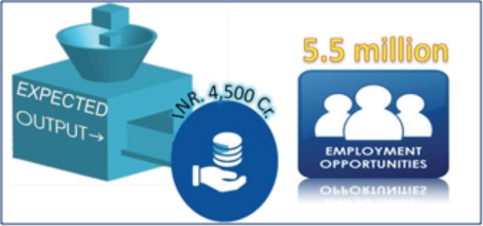
Establish around 750 Nano HUBs in the villages of Maharashtra is an effort to create a small yet compact mechanism to generate employment opportunity and minimize the rural urban migration. Detailed investment and employment opportunity is given in below table:
Conclusion
The imperative of rapid scaling up of the infrastructure capacity – in the Government and private sector (developers, contractors, consultants, financial intermediaries and investors) – entails developing and implementing projects of the required scale and within the tight time frames envisaged. The new initiatives of “16 Smart Secured Cities” on the part of the Government have begun to turnaround the project as far as the private participation is concerned through project execution and planning new investments.

Lastly, to implement an ambitious roadmap for this project, improved standards of secured governance and concerted action would be required to take these targets and goals from inspirational statements to actual development. We need a system to integrate economic interdependence in today’s modern societies which not only decreases uncertainty regarding where risks begin and end, but also help in judicious planning and development of new empowered, transparent and interdependent Governance systems with higher degree of society participation in nation building Process. Secured Governance is a novel concept which equips to create adequate and coordinated measures to ensure the provision of financial, human, technical, information and sustainable economic growth of the state and nation.
Comments
Vishal P
July 10, 2016 AT 9:15 PM
Vishal P
July 10, 2016 AT 9:15 PM
Leave A Comment